Since 2007, we have been quite active in our small but beautiful part of the world. Here are a few things we’ve been doing.
For more, and if you speak Romanian (or Google-Romanian), check out our website.
Meetings and workshops
In partnership with a series of Universities such as The Faculty of Geography – University of Bucharest, the Faculty of Geography – University Babes Bolyai, The Faculty of Chemistry, Biology and Geography – West University of Timisoara, geo-spatial.org has gone beyond the digital border and reached out to the community through straightforwardly contact by organizing practical workshops for presenting the advantages of open source geo solutions. Until now, 19 such events were organized:
- 25 September 2008 – Bucharest (25 participants). Details here.
- 23 October 2008, Iasi (35 participants). Details here.
- 13-14 December 2008 – Brasov (13 participants). Details here.
- 03-04 April 2009 – Cluj Napoca (70+ participants). Details here.
- 16-18 April 2010 – Cluj Napoca (130+ participants). Details here.
- 19-20 November 2010 – Timisoara (100+ participants). Details here and here.
- 15-16 April 2011 – Cluj Napoca (170+ participants). Details here.
- 07-08 October 2011 – Bucharest (120+ participants). Details here.
- 25-26 November 2011 Timisoara (120+ participants). Details here.
- 27-28 April 2012 Cluj Napoca (130+ participants). Details here.
- 12-13 October 2012 Bucharest (110 + participants). Details here.
- 23-24 November 2012 Timisoara (120+ participants). Details here.
- 19-20 April 2013 Cluj Napoca (140+ participants). Details here.
- 15-16 November 2013 Timisoara (110+ participants). Details here.
- 04-05 April 2014 Cluj Napoca (130+ participants). Details here.
- 14-15 November 2014 Timisoara (120+ participants). Details here.
- 24-25 April 2015 Cluj Napoca (130+ participants). Details here.
- 20-21 November 2015 Timi?oara (110+ participants). Details here.
- 15-16 April 2016 Cluj Napoca (110+ participants). Details here.
- 7-8 October 2016 Bucharest (xyz+ participants). Details here.
- 18-19 November 2016 Timisoara (xyz+ participants). Details here.
- 31 March – 1 April Cluj Napoca (xyz+ participants). Details here.
In 2013, we felt confident that we could go bigger.
FOSS4G-CEE 2013 Conference
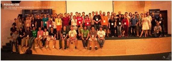
Between 16-20 of June 2013, the geo-spatial.org Association and OSGeo Romania, under the high auspices of the Ministry of Culture and in collaboration with the Romanian Spatial Agency, Romanian National Meteorological Administration, Faculty of Geography – University of Bucharest, Groundwater Engineering Research Center – Technical University of Civil Engineering Bucharest, Faculty of Geography – Babe? Boylai University, Faculty of Chemistry, Biology and Geography – West University of Timisoara, Institute for Research in Artificial Intelligence of the Romanian Academy, Faculty of Silviculture and Forest Engineering – Transilvania University, Brasov, Faculty of Geography and Geology – Alexandru Ioan Cuza University, Iasi, Faculty of History and Geography – ?tefan cel Mare University, Suceava, Dept. of Geophysics and Space Science – Eötvös University of Budapest, Politecnico di Milano, Institute of Cartography and Geoinformation – ETH Zurich”, Military Technical Academy, Faculty of Automatic Control and Computers – University Politehnica of Bucharest, Soros Foundation Romania, Romanian Open Source Education Association, The Sponge Media Inovation Lab and the National Library of Romania, organized the second edition of the international conference “Free and Open Source Software for Geospatial – Central and Eastern Europe” (FOSS4G-CEE). The event was dedicated to present the advantages of using free and open source geospatial technologies. The conference grew apart from a global event (the annual conference Free and Open Source Software for Geospatial / FOSS4G), acknowledged by the entire international geospatial community, with the permission and under the patronage of the organizing institution, the Open Source Geospatial Foundation, driven by the desire of better addressing the specific needs of the geospatial communities from Central and Eastern Europe, such as on the educational and scientific side. In numbers the event looked like this:
- Participants: over 200, from 17 countries (47 participants from outside Romania);
- Oral presentations: 52, (10 keynotes);
- Practical workshops: 12;
- Code Sprint participants: 20;
- GeoData Hackathon participants: 15.
More details here.
We have a deep passion for historical cartography.
eHarta project
eHarta is a collection of thousands of old georeferenced maps, published and documented with the help of the geo-spatial.org community. The eHarta maps are freely available for download as georeferenced files and accessible through a number of web services that fit a broad range of users (e.g. Zoomify tiles or KML files for ordinary users; OGC compliant geospatial web services like WMS/WMTS/WMS-C/TMS/CSW for users with advanced geospatial skills). A webmapping application, which integrates all the old maps published within eHarta project, was implemented on geo-spatial.org. The users can use the left menu to adjust the map content by selecting the visible layers or by adjusting the layers opacity. The top toolbar contains useful instruments for map navigation. Through standard web services the users are able to create mashups using eHarta maps along with data from other geospatial services.
In 2011, the eHarta project won the “Better Data Award” at “Open Data Challenge”. The prize was awarded at the Digital Agenda Assembly, being held in Brussels on 16th and 17th June 2011, by the European Commission Vice-President Neelie Kroes. Organised by the Open Knowledge Foundation and the Open Forum Academy under the auspices of the Share-PSI initiative, the Open Data Challenge invited designers, developers, journalists, researchers and the general public to come up with useful, valuable or interesting uses for open public data. It attracted 430 entries from across the EU. Entries were invited in four categories for prize money totalling €20 000. The categories were fully blown apps, ideas, visualisations and liberated public sector datasets. The winners were selected by open data experts, including the inventor of the world wide web Sir Tim Berners-Lee.


