GeoNetwork provides an easy to use web interface to search geospatial data across multiple catalogs. The search provides full-text search as well as faceted search on keywords, resource types, organizations, scale, … Users can easily refine the search and quickly gets to the records of interests.
GeoSpatial layers, but also services, maps or even non geographic datasets can be described in the catalog. Easily navigate accross records and find sources or services publishing a dataset.
Make your maps
The interactive map viewer based on OpenLayers 3 provides access to OGC services (WMS, WMTS) and standards (KML, OWS). Connected to the catalog, users can easily find new services, layers and even dynamic maps to combine them together. User maps can be annotated and printed and shared with others.
Publish & describe resources
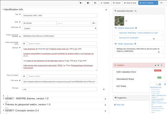
Describe information using the online metadata editing tools. The metadata editor support ISO19115/119/110 standards used for spatial resources and also Dublin Core format usually used for opendata portal.
Based on user profiles (eg. reviewer, editor), a dashboard provides easy access to their informations and tasks. Online editing of metadata is based on a powerful template system and directories of information (eg. contacts, thesaurus).
The editor provides uploading of data, graphics, documents, pdf files and any other content type. It supports among other:
- multilingual metadata editing,
- validation system,
- suggestion to improve metadata quality
- geopublication of layers to publish geodata layers in OGC services (eg. GeoServer)


