The GC2/Vidi framework helps you build a spatial data infrastructure quickly and easily. Powered using open source components for a scalable solution focused on freedom rather than fees.
GC2/Vidi comprises two software projects:
- GC2 – makes it easy to deploy PostGIS, MapServer, QGIS Server, MapCache, Elasticsearch, GDAL/ogr2ogr. And offers an easy-to-use browser application to configure the software stack.
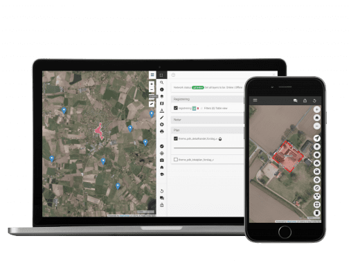
- Vidi – a modern take on browser GIS. It is the front-end client for GC2.
Core features
-
GC2 enables you to:
- Import into PostGIS from different spatial vector and raster formats like ESRI Shape, MapInfo TAB/MIF, GeoJSON, GML, KML, ESRI fileGDB, GeoTIFF and ACS. And non-spatial formats like CSV and MS Access.
- Use roles, versioning and workflow management to take control over your data.
- Make maps using MapServer or QGIS Server and scale to many users with the help of MapCache.
- See and edit your data in applications that supports the OWS standards.
- Use PostGIS SQL language as a web service and get the result as GeoJSON, CSV or Excel.
- Get data from PostGIS indexed in Elasticsearch by a click on a button.
- Deploy the whole software stack using Docker.
-
Vidi enables you to:
- Display GC2 layers as either non-tiled, tiled or vector.
- Query data using geometry and buffers.
- Add drawings with measurements, styles and labels.
- Print scaled PDF maps based on Mustache templates.
- Save, restore and share projects. A project comprises the extent of the map, which background map is visible and which layers are turned on, which filters are applied as well as your drawings.
- Write your own modules using an extension mechanism.
-
Vidi is a Progressive Web App (PWA), which:
- Starts without network.
- Caches vector layers in browser, so they can be used without network.
- Partial caches tiled baselayers in browser for use without network.
- Edits data without network. Transactions are queued and submitted when online again.
Implemented Standards
- Geographic JSON (GeoJSON)
- Georeferenced Tagged Image File Format (GeoTIFF)
- Geography Markup Language (GML)
Mapbox Vector Tile Specification
(MVT)- Simple Features for SQL (SFSQL)
- Web Map Tile Service (TMS)
- Web Feature Service (WFS)
- Web Feature Service - Transactional (WFS-T)
- Web Map Service (WMS)
- Web Map Service - Tile Caching (WMS-C)
- Web Map Tile Service (WMTS)


